St. Bethlehem, around I-24 Exit 4 and Wilma Rudolph Boulevard, is mostly zoned for Rossview High, graded A. It spans ZIP codes 37040 and 37043.
Last checked Oct. 17, 2026. Sources: the Clarksville-Montgomery County Comprehensive Plan (PDF), St. Bethlehem planning area; the CMCSS 2026-27 middle and high school zone map (PDF); the Tennessee Department of Education’s 2024-25 A-F letter grade file; the federal NCES school directory; the Zillow Home Value Index (Zillow Research); Tennessee State Parks’ Dunbar Cave page; and OpenStreetMap (© OpenStreetMap contributors).
St. Bethlehem is Clarksville’s main shopping district and the neighborhoods around it, between the Red River and Interstate 24. The county’s Comprehensive Plan says it holds a large share of the city’s regional and corridor commercial development along Wilma Rudolph Boulevard (U.S. 79), from Governor’s Square mall out to Exit 4, with residential neighborhoods on both sides of the boulevard. It also names two big open spaces: Dunbar Cave State Park and the Austin Peay Recreation Area.
What this means for you
- Zoned high school: mostly Rossview High, 1237 Rossview Road (2024-25 state letter grade: A); parts are zoned for Kenwood (D), Northeast (B) or Kirkwood (A).
- Home value: $304,511 in ZIP code 37040 and $398,124 in 37043 in September 2026, according to the Zillow Home Value Index.
- Nearest I-24 exit: Exit 4 (U.S. 79, Wilma Rudolph Boulevard), about a mile from Governor’s Square in a straight line.
Part of our Clarksville neighborhoods guide.
Where it is
The plan’s boundaries are the Red River to the south and west, Spring Creek to the north and Interstate 24 to the east. Wilma Rudolph Boulevard, Trenton Road, Warfield Boulevard, Needmore Road, Whitfield Road and Rossview Road are the main roads. The Census Bureau’s ZIP code areas split it: about half in 37040 and half in 37043.
The plan’s list for the area:
- Road work: the Spring Creek connector and extending Spring Creek Parkway to Wilma Rudolph Boulevard; widening Warfield Boulevard from Dunbar Cave Road to U.S. 41A; finishing the Needmore Road and Whitfield Road roundabout work; extending Professional Park Drive to Cardinal Lane and Merchants Boulevard to Trenton Road; adaptive traffic signals on Wilma Rudolph Boulevard
- Support for a possible new Exit 6 on I-24
- Redevelopment around the mall and of aging big-box centers into walkable centers with homes
- Medical and Class A office space mixed with walkable retail
- The Exit 8 Athletic Complex, with walking trails and a playground, and better walking access to Dunbar Cave
- Gateway work at Wilma Rudolph Boulevard and I-24 and at Exit 8
Schools
We read the district’s 2026-27 middle and high school zone map at 181 points across the area, the largest share of any area in this guide because St. Bethlehem is split four ways:
- Rossview High and Rossview Middle: 102 points, the south and east of the area, toward Dunbar Cave and Exit 8
- Kenwood High and Kenwood Middle: 50 points, the west side toward the Red River
- Northeast High and Northeast Middle: 25 points, the north toward Spring Creek
- Kirkwood High and Kirkwood Middle: four points, just north of Exit 4
Grades are from the state’s 2024-25 A-F letter grades:
| High school | Address | 2024-25 grade | Middle school | Grade |
|---|---|---|---|---|
| Rossview High | 1237 Rossview Road | A | Rossview Middle, 2265 Cardinal Lane | A |
| Kenwood High | 251 E. Pine Mountain Road | D | Kenwood Middle, 241 E. Pine Mountain Road | B |
| Northeast High | 3701 Trenton Road | B | Northeast Middle, 3703 Trenton Road | D |
| Kirkwood High | 2702 Rossview Road | A | Kirkwood Middle, 2700 Rossview Road | A |
Elementary schools inside the area, from the federal NCES directory:
- Rossview Elementary, 2235 Cardinal Lane (pre-K to 5; 2024-25 grade C)
- Glenellen Elementary, 825 Needmore Road (pre-K to 5; B)
- St. Bethlehem Elementary, 2450 Old Russellville Pike (pre-K to 2)
Rossview High, Rossview Middle and Rossview Elementary share a campus off Rossview Road and Cardinal Lane. The elementary zone for a street is on the district’s elementary zone map (PDF). Check one address in the bus and zoning lookup and see full results on the Tennessee State Report Card. More in our schools guide.
Home values
Zillow’s typical home value for ZIP code 37040 was $304,511 in September 2026, up 0.6% from $302,676 a year earlier, and for 37043 it was $398,124, up 0.9% from $394,461; the city figure was $317,914. The index is a modeled value for a typical mid-priced home, not a sale price, and Zillow does not publish it below the ZIP code level, so it cannot separate St. Bethlehem from the other parts of each ZIP. More in home prices.
Parks and trails
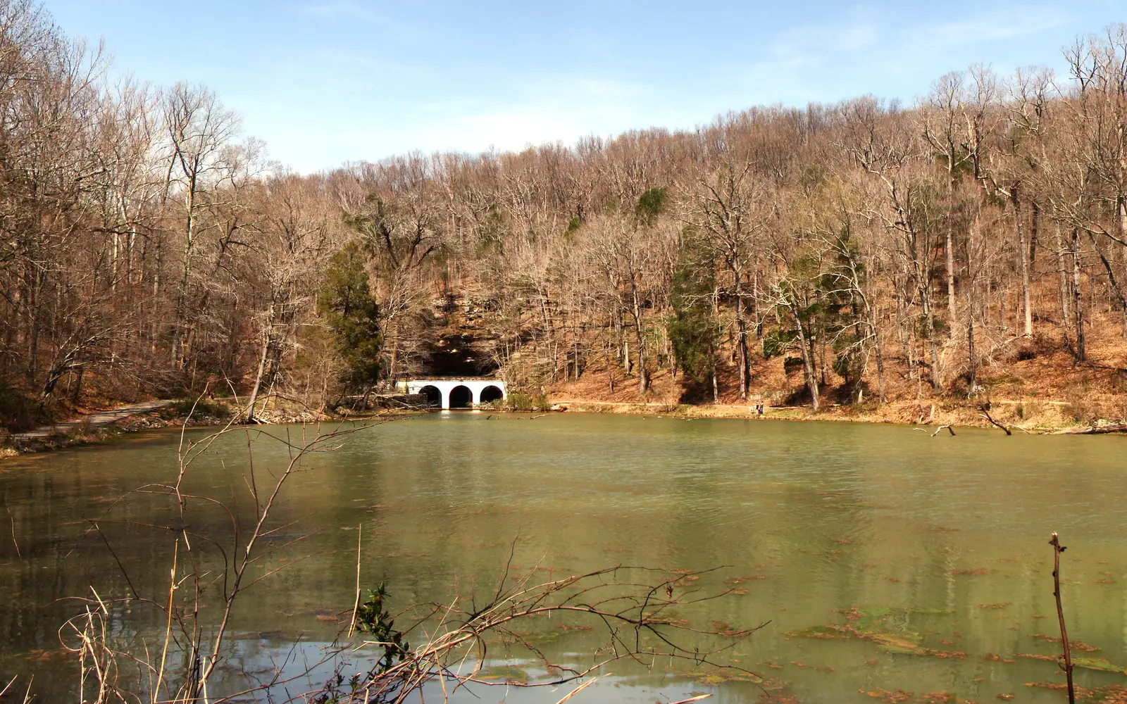
- Dunbar Cave State Park, 401 Old Dunbar Cave Road: 140 acres around the cave, with trails including the Lake Trail around Swan Lake. Visitor center: 931-648-5526.
- Swan Lake Sports Complex, 2002 Sanders Road: softball fields, a playground and a pavilion.
- The Austin Peay Recreation Area and the St. Bethlehem Civitan Sports Complex, from OpenStreetMap and the plan’s map.
- The River Club Golf and Learning Center, on the plan’s map.
Hours and more in parks and trails.
Getting around
- Main roads: Wilma Rudolph Boulevard (U.S. 79), Trenton Road, Warfield Boulevard and Needmore Road.
- Interstate: Exit 4 (U.S. 79, Wilma Rudolph Boulevard and Guthrie Highway) is in the area; Exit 8 (State Route 237, Rossview Road) is at its southeast corner. Exit names are from OpenStreetMap.
- Distances by road from Governor’s Square, 2801 Wilma Rudolph Blvd., measured on OpenStreetMap’s road network: about 6.2 miles to Public Square downtown and about 54 miles to Nashville International Airport. These are distances, not drive times.
- Buses: Clarksville Transit System routes run out from the Transit Center, 200 Legion St.; see the CTS route map for the stops nearest an address.
More in getting around.
Groceries and everyday stores
From OpenStreetMap:
- Kroger, 2100 Lowes Drive
- Publix, 2300 Trenton Road
- Walmart Supercenter, with a pharmacy, 3050 Wilma Rudolph Blvd.
- Walmart Neighborhood Market, 2551 Whitfield Road
- Gordon Food Service Store and a Walgreens pharmacy
- Governor’s Square mall, 2801 Wilma Rudolph Blvd., and Governor’s Square Plaza next to it
Related: North Clarksville, Sango, Black Friday and holiday shopping and property taxes.
Frequently asked questions
Where is St. Bethlehem in Clarksville?
On the northeast side. The county’s Comprehensive Plan bounds the St. Bethlehem planning area by the Red River to the south and west, Spring Creek to the north and I-24 to the east, taking in Exit 4 and Wilma Rudolph Boulevard.
What high school is St. Bethlehem zoned for?
Mostly Rossview High: 102 of the 181 points we read on the district’s 2026-27 zone map. The west side is in the Kenwood High zone, the north in the Northeast High zone and a few points near Exit 4 in the Kirkwood High zone.
Is St. Bethlehem a good place to live?
Here are the facts. St. Bethlehem holds Governor’s Square mall, Dunbar Cave State Park and five supermarkets; most of it is zoned for Rossview High, graded A for 2024-25; and the typical home value was $304,511 in ZIP 37040 and $398,124 in ZIP 37043 in September 2026, according to Zillow.
What exit is St. Bethlehem off I-24?
Exit 4, where U.S. 79 (Wilma Rudolph Boulevard toward Clarksville, Guthrie Highway toward Guthrie, Kentucky) crosses the interstate. Exit 8, State Route 237 at Rossview Road, is at the area’s southeast corner.
Have your say