New Providence, across the Red River from downtown, is mostly zoned for Kenwood High. ZIP 37042 was $290,703 in September 2026, according to Zillow.
Last checked Oct. 17, 2026. Sources: the Clarksville-Montgomery County Comprehensive Plan (PDF), New Providence planning area; the CMCSS 2026-27 middle and high school zone map (PDF); the Tennessee Department of Education’s 2024-25 A-F letter grade file; the federal NCES school directory; the Zillow Home Value Index (Zillow Research); and OpenStreetMap (© OpenStreetMap contributors).
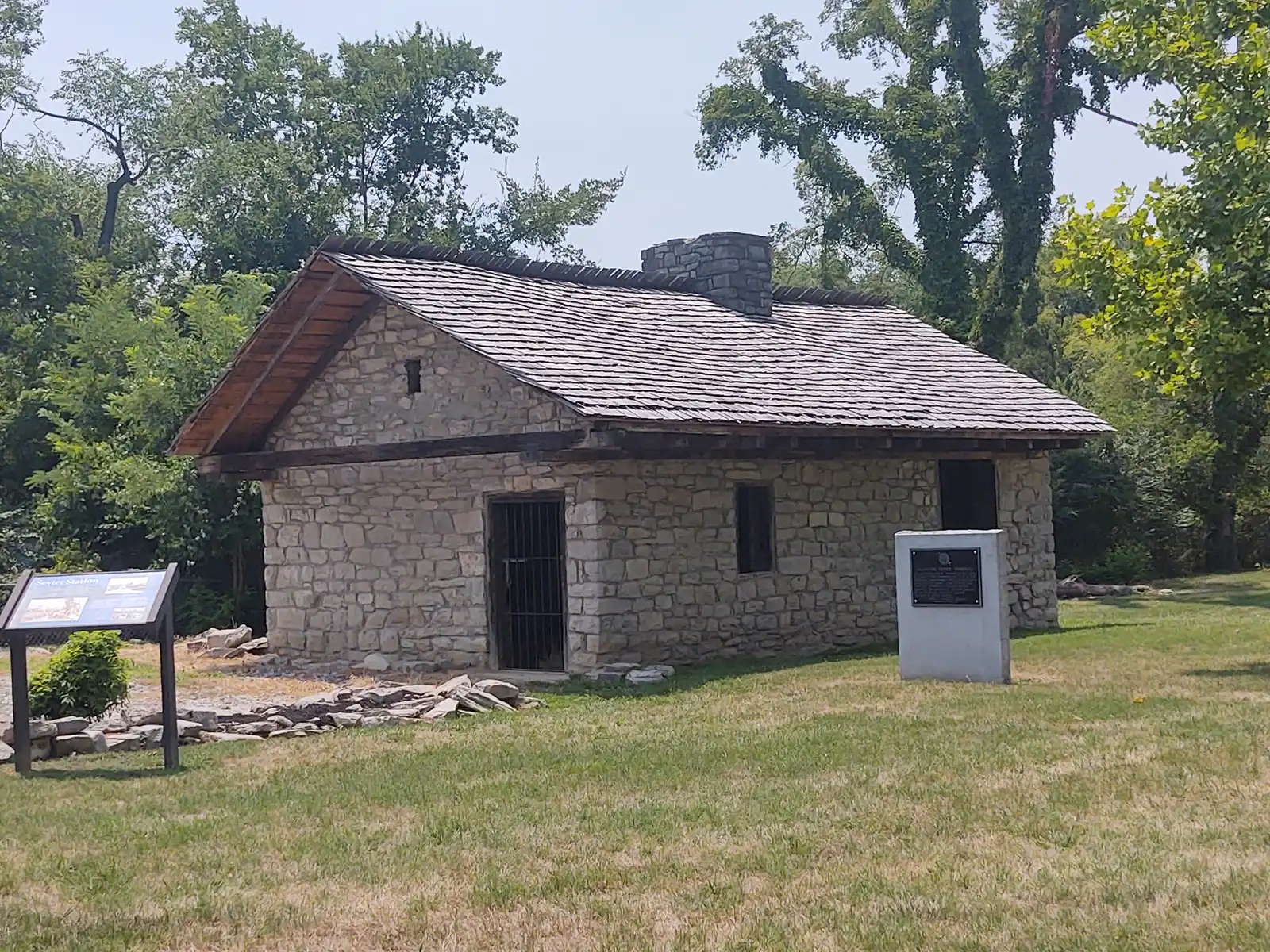
New Providence sits across the Red River from downtown, in the corner where the Red meets the Cumberland. The county’s Comprehensive Plan says the Red River once marked the line between Clarksville and the separate town of New Providence, which was annexed long ago and is now regarded as a Clarksville neighborhood. Its main street is Providence Boulevard, which the plan calls an aging strip commercial corridor with good connections to Fort Campbell, downtown and Tiny Town Road. The plan also says the area holds significant parks, landmarks and historic sites, including Trice Landing Park, Sevier Station and Fort Defiance on the Cumberland.
What this means for you
- Zoned high school: mostly Kenwood High, 251 E. Pine Mountain Road (2024-25 state letter grade: D); the west end is in the Northwest High zone (B).
- Home value: $290,703 in ZIP code 37042 in September 2026, according to the Zillow Home Value Index.
- Nearest I-24 exits: Exit 1 (State Route 48) and Exit 4 (U.S. 79), each about 7 miles away in a straight line.
Part of our Clarksville neighborhoods guide.
Where it is
The plan’s boundaries are the Cumberland and Red rivers to the south, the West Fork of the Red River to the east, and census tract lines to the north and west. Providence Boulevard and Peachers Mill Road are the main roads, with Dover Road at the west end. The plan notes that floodplains, steep hills, the quarries and the rivers leave little room to extend local streets. Almost all of the planning area is inside the city, in ZIP code 37042.
The plan’s list for the area:
- A pedestrian bridge across the Red River linking the Clarksville Greenway to the Riverwalk, downtown and the Austin Peay greenway
- Develop Providence Boulevard as a gateway corridor for downtown and North Clarksville, with a redevelopment district to draw new businesses
- Pedestrian safety along Providence Boulevard
- Redevelop aging homes and commercial buildings, keep a mix of affordable housing types and add “missing middle” housing where the infrastructure exists
- Enhancements to Trice Landing as a river access point, under way when the plan was written
- Better signs and access for the historic sites, and no development around the quarry
Schools
We read the district’s 2026-27 middle and high school zone map at 21 points across the area. Seventeen were in the Kenwood High and Kenwood Middle zone. Four at the west end, near Dover Road, were in the Northwest High and New Providence Middle zone. Grades are from the state’s 2024-25 A-F letter grades:
| Level | School | Address | 2024-25 grade |
|---|---|---|---|
| Middle | Kenwood Middle | 241 E. Pine Mountain Road | B |
| High | Kenwood High | 251 E. Pine Mountain Road | D |
| Middle | New Providence Middle (west end) | 146 Cunningham Lane | C |
| High | Northwest High (west end) | 800 Lafayette Road | B |
On the state’s components, Kenwood High earned a C for achievement, an F for growth, a C for growth among its lowest-scoring students and a D for college and career readiness. The elementary school inside the area, from the federal NCES directory, is Byrns Darden Elementary, 609 E St. (pre-K to 5; 2024-25 grade C). The elementary zone for a street is on the district’s elementary zone map (PDF). Check one address in the bus and zoning lookup and see full results on the Tennessee State Report Card. More in our schools guide.
Home values
Zillow’s typical home value for ZIP code 37042 was $290,703 in September 2026, down 0.1% from $290,891 a year earlier; the city figure was $317,914. The index is a modeled value for a typical mid-priced home, not a sale price, and Zillow does not publish it below the ZIP code level. 37042 also covers Lafayette Peachers Mill and most of North Clarksville. More in home prices.
Parks and trails
- Trice Landing Park, 99 Oak St.: a Cumberland River boat ramp and pavilion.
- Fort Defiance Park and Sevier Station, which the plan lists among the area’s historic sites.
- Lettie Kendall Park, the New Providence Recreation Area, Beech Street Park and the North Ford Street mountain bike trails, from the plan’s map and OpenStreetMap.
More in parks and trails, history and landmarks and walking and biking trails.
Getting around
- Main roads: Providence Boulevard, Peachers Mill Road and Dover Road.
- Interstate: I-24 is about 7 miles away in a straight line; Exit 1 (State Route 48) and Exit 4 (U.S. 79) are closest. Exit names are from OpenStreetMap.
- Distances by road from 216 Dover Road, measured on OpenStreetMap’s road network: about 3 miles to Public Square downtown and about 59 miles to Nashville International Airport. These are distances, not drive times.
- Buses: Clarksville Transit System routes run out from the Transit Center, 200 Legion St.; see the CTS route map for the stops nearest an address.
More in getting around.
Groceries and everyday stores
From OpenStreetMap:
- Walmart Neighborhood Market, 216 Dover Road
- Town and Country Drugs, 226C Dover Road, next door
For a larger choice, the Fort Campbell Boulevard stores are listed in our Lafayette Peachers Mill guide.
Related: Downtown and property taxes.
Frequently asked questions
Where is New Providence in Clarksville?
Across the Red River from downtown. The county’s Comprehensive Plan bounds the New Providence planning area by the Cumberland and Red rivers to the south and the West Fork of the Red River to the east, with Providence Boulevard and Peachers Mill Road as its main roads.
Was New Providence a separate town?
Yes. The county’s Comprehensive Plan says the Red River once marked the boundary between Clarksville and New Providence, which was annexed long ago and is now regarded as a neighborhood of Clarksville.
What high school is New Providence zoned for?
Mostly Kenwood High and Kenwood Middle: 17 of the 21 points we read on the district’s 2026-27 zone map. Four at the west end, near Dover Road, were in the Northwest High and New Providence Middle zone.
Is New Providence a good place to live?
Here are the facts. New Providence holds Trice Landing, Sevier Station and Fort Defiance on the Cumberland River; most of it is zoned for Kenwood High, graded D for 2024-25; and the typical home value in ZIP 37042 was $290,703 in September 2026, according to Zillow.
Have your say